Notes
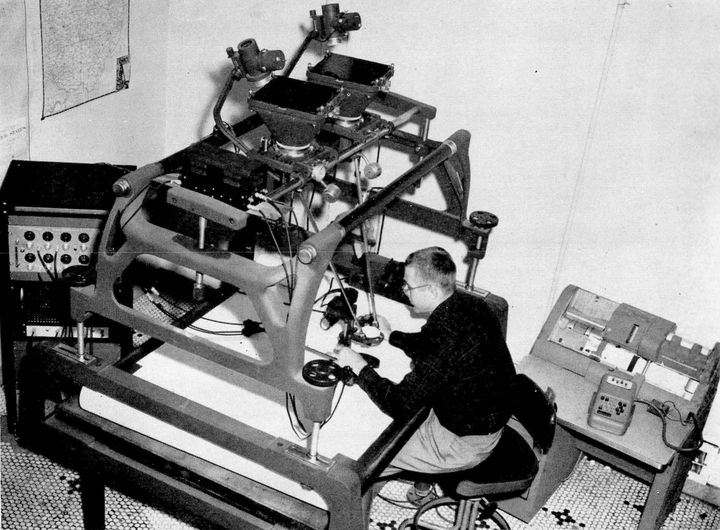
Kelsh Projection Stereoplotter (1960). This was an automatic digital data input system used in conjunction with the photogrammetric plotter. The stereoplotter required two aerial photographs that have considerable overlap (60%). The photos are put onto transparent media and projected with a light source. Each image will be projected with overlap on the other. The operator, using a special set of optics, would then see the image as three-dimensional due to the differing perspective of each photo. The stereoplotter can then be used to determine elevations and can plot contour lines on topographic maps based on measurements of the apparent change in position of a feature in the two stereo photographs, pictorial information can then be converted into digital data for computer input. This equipment was developed in a research program for the Ohio State Department of Highways, Columbus, Ohio, by Battelle Memorial Institute. It was a standard highway engineering tool, used to make many measurements from aerial photographs that formerly had to be made in the field by survey crews. The data recording device (left), when used with the stereoplotter, makes it possible to automatically record measurements on punch cards in the IBM punch card unit (right).