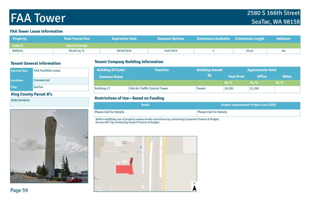
Property Total Parcel Size Expiration Date Renewal Options Extensions Available Extensions Length Holdover Lease # Square Footage #000224 99,626 sq. ft. 09/30/2019 Until 2079 3 20 yrs No FAA Tower Building ID Code/ Common Name Function Building Owned By Approximate Total Foot Print Office Whse. Sq. ft. Sq. ft. Sq. ft. Building 17 FAA Air Traffic Control Tower Tenant 10,291 11,291 FAA Tower Lease Information Tenant Company Building Information 2580 S 166th Street SeaTac, WA 98158 Tenant General Information Current Use: FAA Facilities Lease Location: Commercial City: SeaTac Page 59 King County Parcel #’s #2823049016 Restrictions of Use—Based on Funding Bonds Airport Improvement Project Fund (AIP) Please Call for Details Please Call for Details Before modifying use of property assess bonds restrictions by contacting Corporate Finance & Budget. Access AIP’s by contacting Airport Finance & Budget. FAA Tower Lease #000224 Air Cargo Rd Hardstand 4 Alaska Cargo Hardstand 5 Cargo 4S FAA Tower C om m er ci al Aerial Photo Taken Spring 2012 100 20050 Feet inch = 100 feet Page 60 Port of Seattle Lease Boundary Date Published: 12-31-2014 Disclaimer: This map is for general reference only. Data Layers that appear on this map may or may not be accurate, current, or otherwise reliable. THIS MAP IS NOT TO BE USED FOR NAVIGATION.Open full document
Notes
The Control Tower at Sea-Tac Airport is one of over fifty properties owned by the Port Of Seattle.