Notes
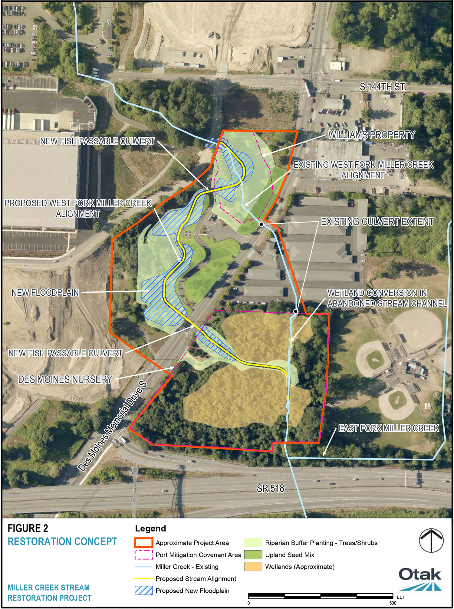
An aerial map showing the restoration concept for Miller Creek Stream, including proposed new stream alignment, floodplain areas, fish passable culverts, and wetland conversion areas. The project area is outlined in red and includes existing and proposed infrastructure modifications along West Fork Miller Creek and East Fork Miller Creek.