Notes
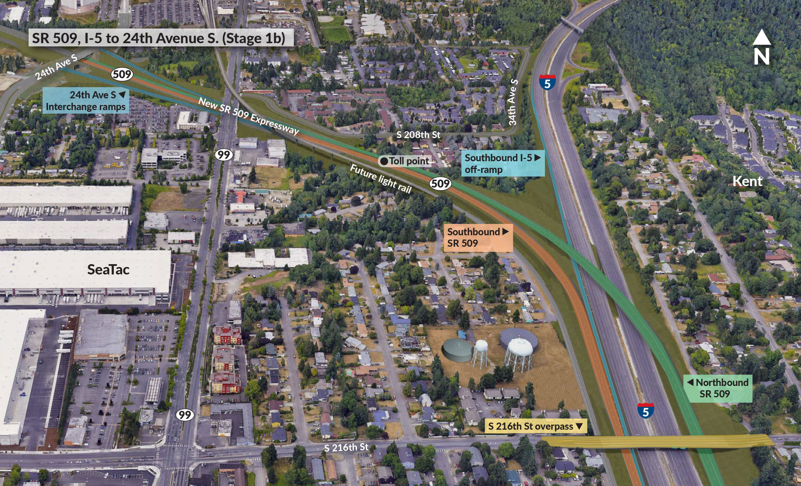
Aerial view map showing the SR 509 expressway construction project from I-5 to 24th Avenue S, including interchange ramps, toll points, and future light rail connections. The map displays the Kent area with various residential neighborhoods and commercial facilities including SeaTac airport vicinity.