Paine Field International Airport (PAE) in Everett could see some notable expansions in the coming years to support increasing commercial passenger demand. Snohomish County, which owns the airport grounds but not the passenger terminal itself, has developed a draft master plan that is pending final approval from the Federal Aviation Administration and county council. That master plan calls for incremental expansion of the passenger terminal and modifications to the airport grounds, such as taxiways and service roads.
PAE commercial service could grow modestly in time
Passenger service at PAE was many years in the making with requests by airlines to open commercial operations, lawsuits, threats of federal enforcement actions, and extensive environmental reviews. Propeller Airports, a private company, took on a project in 2014 to build out the terminal on long-term leased land, breaking ground in mid-2017 and opening formally for service in early 2019.
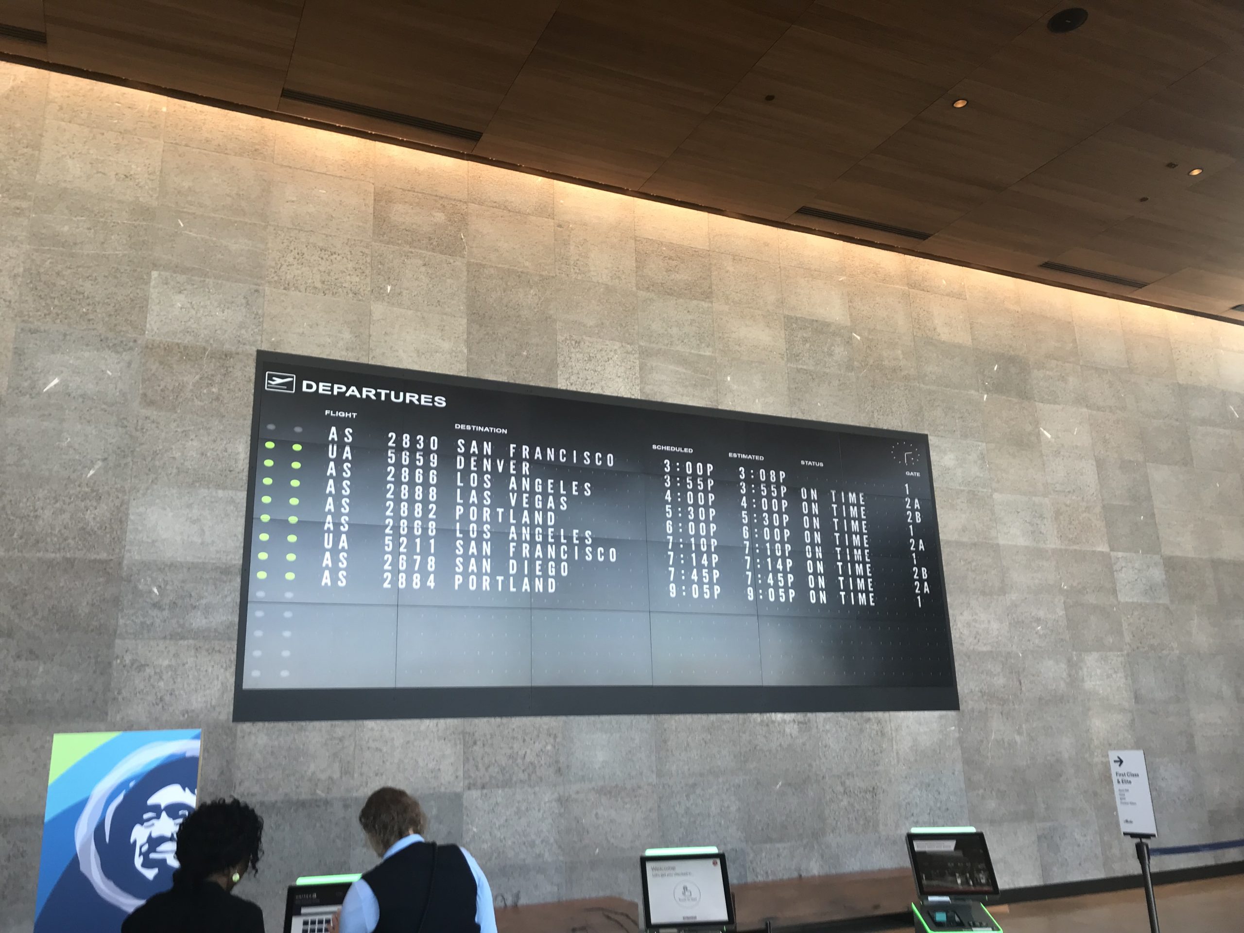
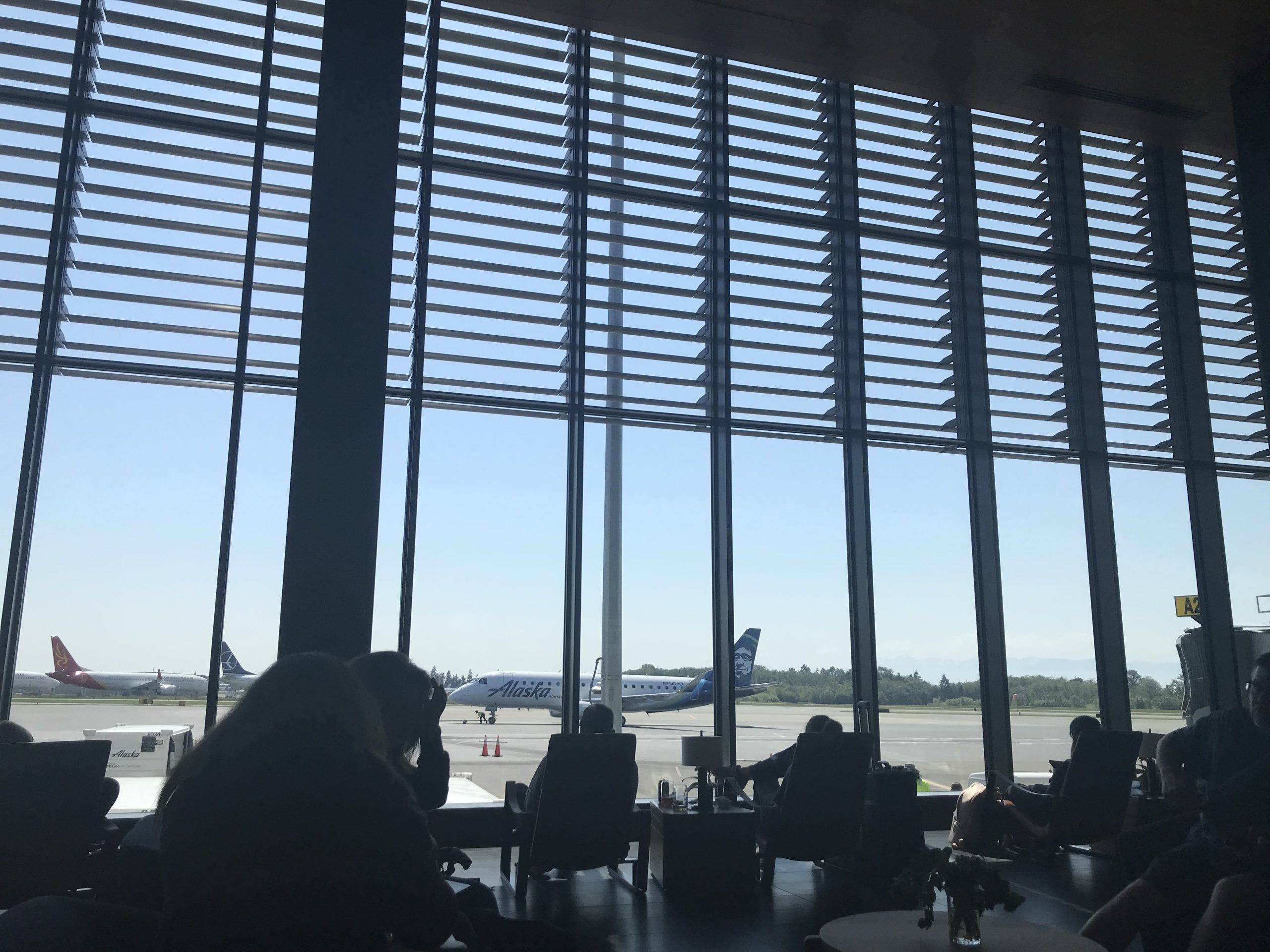
Right now, Alaska Airlines dominates service in and out of the airport with 10 routes, a consequence of United Airlines retreating from the market in 2021 and ceasing all operations that October. Kenmore Air is the only other commercial operator with three routes, but it carries less than 1% of all passengers.
As of last year, the airport still serves under one million passengers per year, even after rebounding passenger volumes since the pandemic. But Snohomish County’s master plan assumes that passenger demand will rise to 4.3 million passengers over the next 20 years. The master plan therefore outlines three “Planning Activity Level” (PALs or Levels, for short) for the purposes of defining the type of airport improvements required to support anticipated demand levels.
- Level 1 equates to about one million annual passengers and 148,478 annual flight operations (16,660 passenger operations and 125,131 general aviation operations). Total operations at this level is considerably higher than the baseline in 2019 even though passenger operations are not.
- Level 2 equates to about 1.5 million annual passengers and 155,028 annual flight operations (18,741 passenger operations and 129,359 general aviation operations).
- Level 3 equates to about 4.3 million annual passengers and 187,303 annual flight operations (41,506 passenger operations and 138,282 general aviation operations).
In the master plan, high level facility requirements are outlined for the different PALs as compared today. Of most interest to passengers, terminal size would be progressively upsized, growing by about five times from what it is today and the number of gates would increase from three to 15. Passenger parking spaces would also increase, but less dramatically from about 970 to 2,600, though whether or not other off-site parking businesses would open is beyond the scope of the master plan.
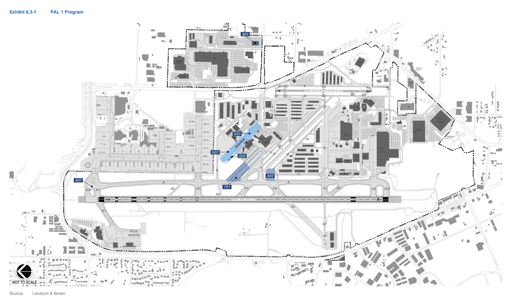
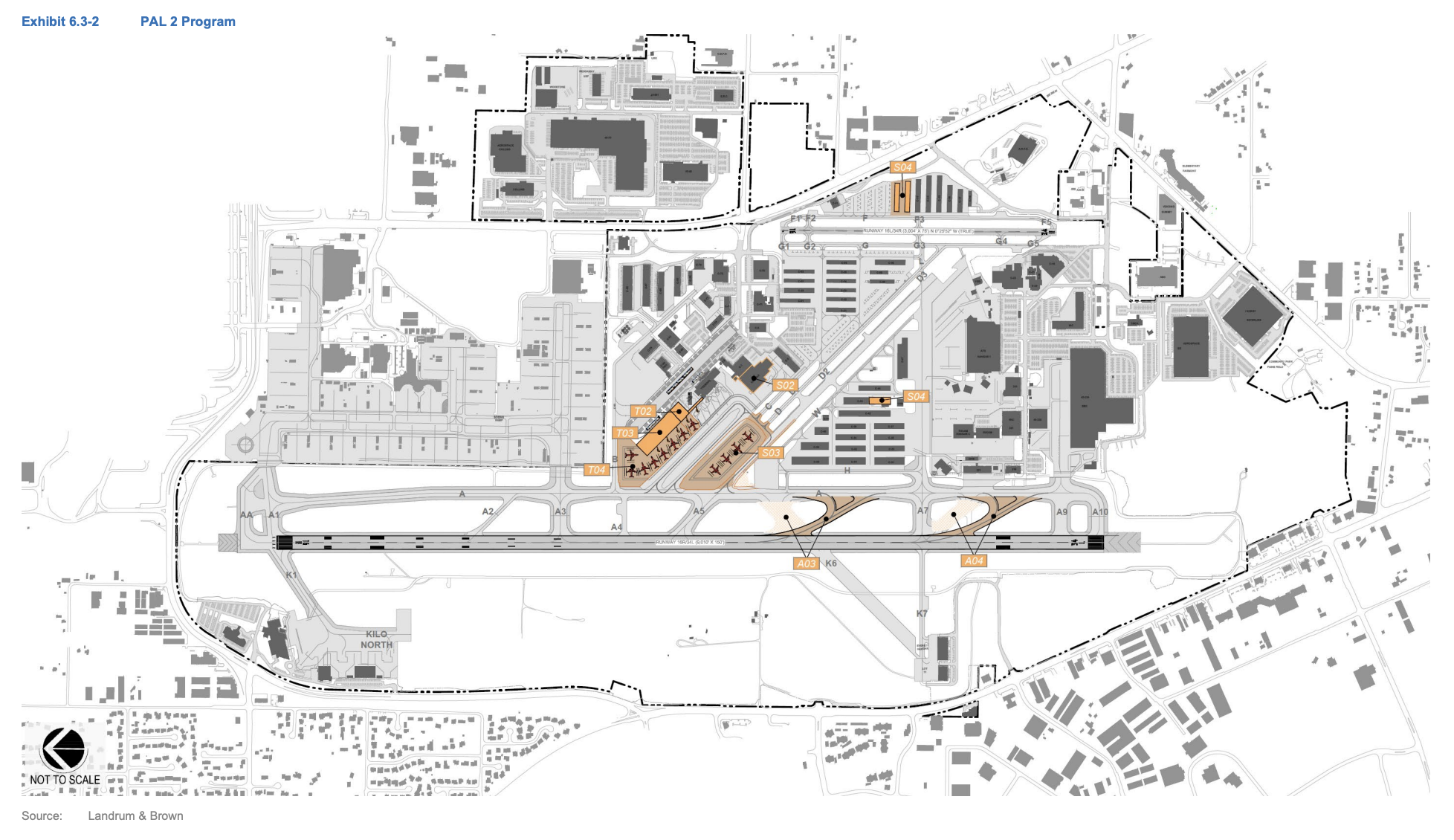
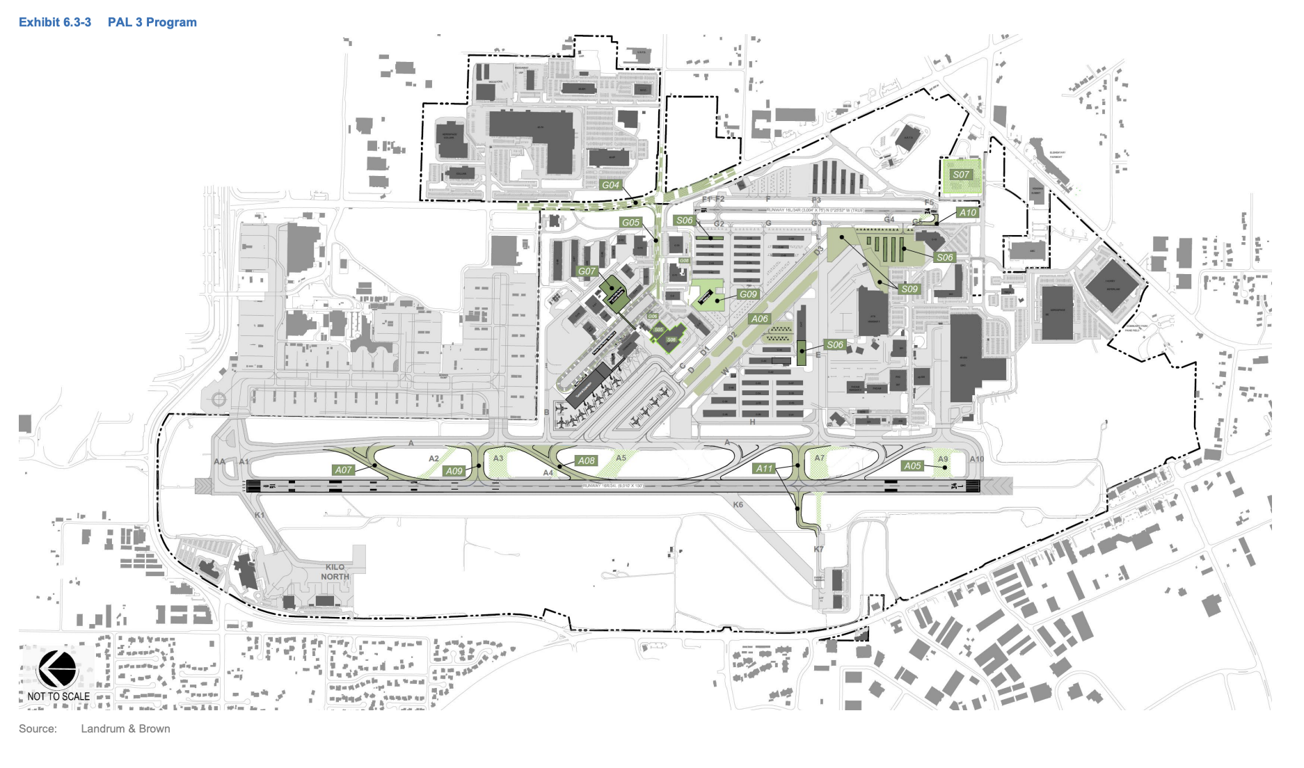
In terms of how each PAL is expected to develop, the master plan provides separate maps showing the incremental changes.
At the PAL 1 phase, passengers would most likely notice changes to the terminal loop road, terminal curb area, and expanded surface parking lot in this phase.
At the PAL 2 phase, passengers would see a much bigger impact with changes as the terminal progressively expands and other improvements near the terminal are carried out.
Finally, at the PAL 3 phase, passengers would most notice changes around the Airport Road/100th Street SW intersection, airport drive, and expansion of parking facilities. That includes construction of a new six-level parking garage within a short walking distance north of the airport terminal and conversion of a surface parking to the east to as a staging area for ride-shares, valets, and shuttles.
Transportation access to evolve but not exactly for better
In time, PAE expects to see changes to the local transportation system, particularly at its doorstep.
Around 2034, the master plan projects that the Airport Road intersection at 100th Street SW will require substantial modifications due to signal constraints. “The operational analysis indicates that the intersection, in its current configuration will reach an unacceptable level of service between PAL 2 and PAL 3… with delays of 60 seconds or more,” the master plan states.
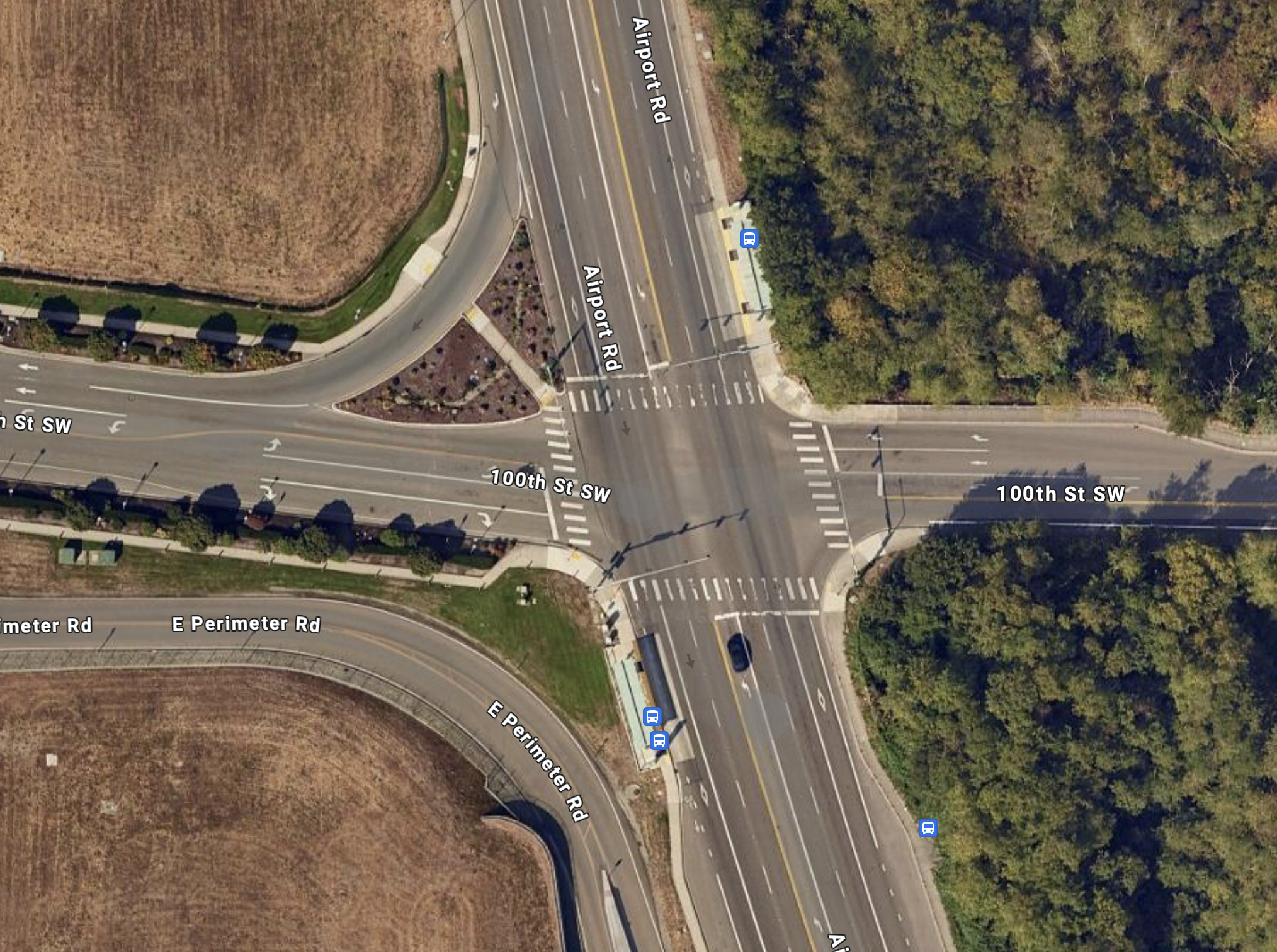
The intersection is currently signalized with single left-turn lanes on all four sides. In addition to those turn pockets, Airport Way has two general purpose lanes and one bus lane in each direction and 100th Street SW has a variable number of lanes but reaches five lanes at its widest. On top of this, there is a southbound slip lane separated from the intersection by a “pork chop” from Airport Way to 100th Street SW.
The master plan considered two options for modifying the intersection: an expanded version of the signalized intersection or a roundabout. Both options are wide and designed for highway speeds, but the roundabout would actually move more vehicle capacity despite having a much smaller footprint. However, the expanded signalized intersection would have bike lanes — very narrow and unprotected ones at that — and high occupancy vehicle (HOV) lanes unlike the roundabout alternative. Roundabouts, such as the one envisioned here, are usually safer and less intense for those walking, rolling, and biking though.
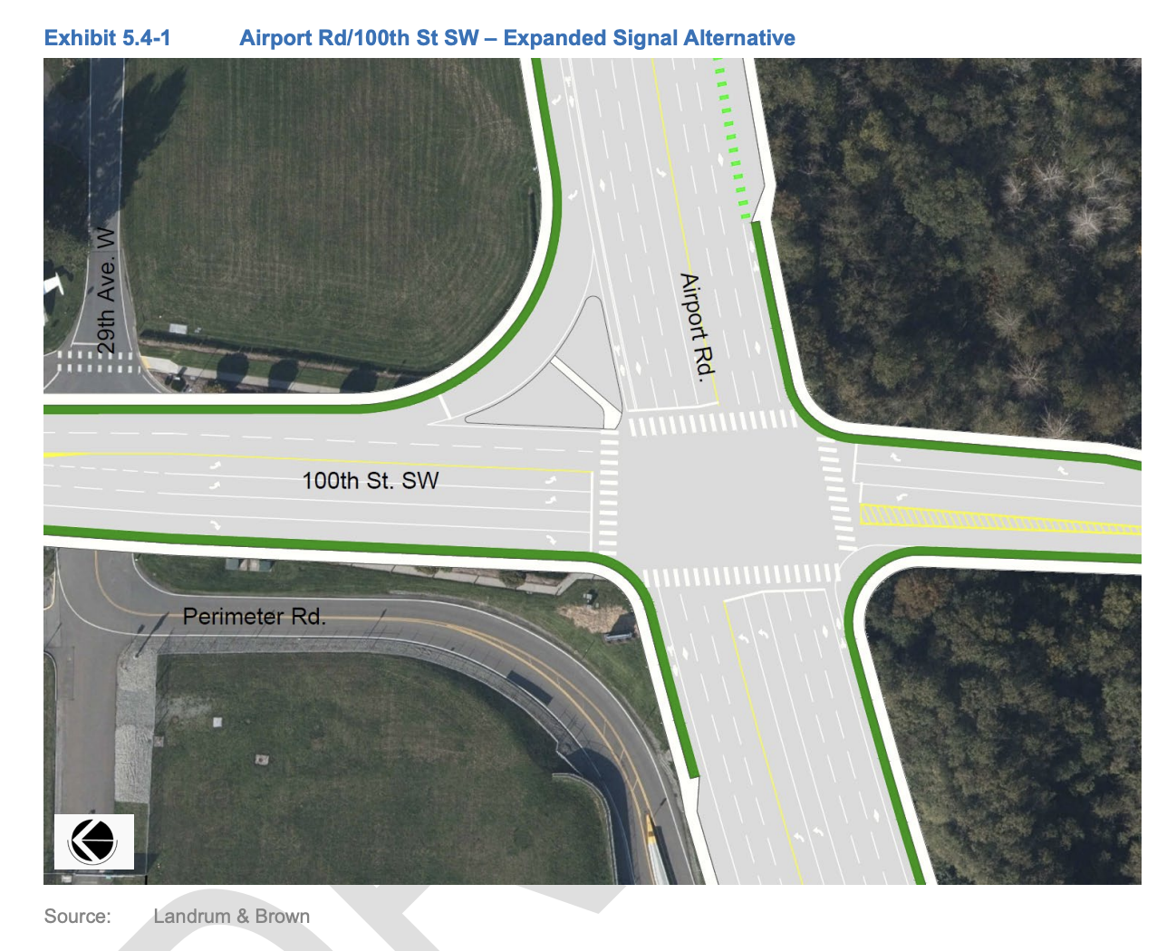
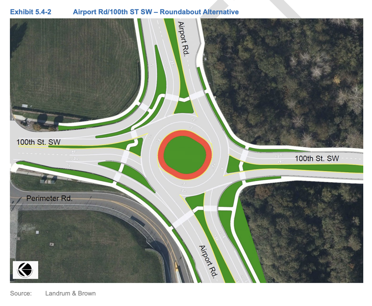
In making a recommendation, the master plan concludes that an expanded signalized intersection is the better path forward.
“While the roundabout alternative offers increased capacity compared to the signalized intersection, the incompatibilities with the existing BRT and HOV routes, and the planned light rail line in the Airport Road corridor make it a poor solution when considering the greater transportation system surrounding PAE,” the master plan states.
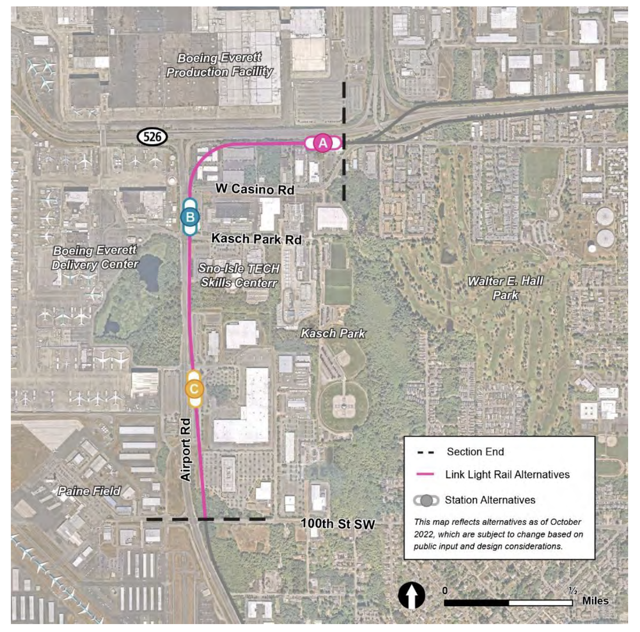
That conclusion is apparently reached on the basis that HOVs and buses would have to merge into general purpose lanes and that the “roundabout concept is also incompatible with the light rail line and potential stop recently planned at this location.” Nevertheless, those assertions are largely erroneous. Articulated buses like the ones uses on Community Transit’s Swift lines can navigate wide roundabouts like the one conceived, with particular ease when going straight through, and no light rail stop is planned at this location. Sound Transit is also planning to grade-separate the light rail alignment which is not in conflict with the road.
In fact, Sound Transit is studying three light rail station alternatives to the north of 100th Street SW. The nearest one is in the vicinity of 94th Street SW on Airport Road (about a 15-minute walk or 0.75 miles from the terminal), but that alternative is a secondary option and was not seen favorably by Snohomish County officials. The other closest option, also a secondary alternative, is at Kasch Park Road on Airport Road (about a 20-minute walk or one mile from the terminal). Instead, the most likely location is the preferred alternative on SR 526 near Casino Road (about a 34-minute walk or 1.75 miles from the terminal).
Consequently, few passengers and workers will likely choose to use light rail to reach the terminal since walking times from the preferred station location will be prohibitively long and would require some additional bus connection and potential walk to complete “the last mile” in reaching the terminal. Plus, that’s after likely having taken some other connection (e.g., bus, ridehail/taxi, or carpool) to reach the initial light rail station to enter the Link system. Adding up all the time penalties and travel time, light rail could be more of a headache for most would-be riders than a sensible choice to reach the airport.
Nevertheless, buses do serve the area now. Route 105, a local bus route, provides hourly or better weekday service and hourly weekend service along Airport Road with a stop at 100th Street SW. The Swift Green Line provides much more frequent service along that corridor, also stopping there, with frequency as high as every 12 minutes. But both routes require that 15-minute walk to the terminal. Everett Transit, however, directly serves the terminal with Route 8, but it’s a bit of a milk run and only hourly with poor span of service.
The bottom line is that transit service to the airport terminal isn’t stellar and if there’s any future improvements, it won’t be coming from light rail alone. Throwing in an expanded signalized intersection, too, would only add to the area’s woes, cementing driving as the near-universal mode choice for the airport.
PSRC seeks a second major airport, but will it be PAE?
With the master plan draft all but sure to be finalized, it raises the question about PAE’s status as the region’s second major airport.
Whether or not it be is still unclear. That’s because back in 2019, the Puget Sound Regional Council estimated that commercial aviation demand would reach somewhere between 98.6 million and 111.2 million passengers by 2050. The region’s principal airport, Seattle-Tacoma International Airport, would likely have capped out at 66 million passengers by the early 2030s, meaning that somewhere between 32.6 million and 45.2 million passengers would need to be accommodated elsewhere in the following decades.
To address this, state lawmakers commissioned an advisory committee in 2019 to short list potential sites for another major airport. PAE did make into that process as a potential contender for capacity increases, but the committee had strong interest in greenfield sites for a new two-runway airport well into rural areas, such as locations in Pierce County southeast of Joint Base Lewis-McChord (JBLM) and a location in Thurston County southeast of Olympia, and floating the idea of a location near Enumclaw.
Shortlisting those rural airport alternatives, however, proved disastrous for the committee. Rural communities vehemently opposed the idea over noise, pollution, and traffic impacts and several of the options were seen to conflict with JBLM operations. That led to condemnation by the Pierce County Council and Thurston County Council, and consequently the committee ended in debacle with state lawmakers sunsetting the commission before a single airport could be short-listed.
While that could ultimately put pressure on PAE to pick up the pace for expansion in absence of an obvious alternative, there isn’t a statewide committee actively steering the state apparatus to make PAE do so. Though a new committee was commissioned last year to periodically advise on state aviation needs and alternatives, which may involve recommendations to expand existing airports in the region like PAE.
So whether PAE will cap out at 4.3 million annual passengers in the years ahead, as the master plan envisions, or grows to support many millions more is something we’ll all just have to wait and see.

Stephen Fesler
Stephen is a professional urban planner in Puget Sound with a passion for sustainable, livable, and diverse cities. He is especially interested in how policies, regulations, and programs can promote positive outcomes for communities. With stints in great cities like Bellingham and Cork, Stephen currently lives in Seattle. He primarily covers land use and transportation issues and has been with The Urbanist since 2014.